
The Klein Karoo has gone by many names. The Khoi called it “Xanga” which means “The valley between the hills” and later it evolved into the word “Cango”. “Kannaland” was also used by Europeans in the mid 1800s with the name derived from the shrub “Kanna” which is a prominent plant in the area. The Afrikaans name “Klein Karoo” comes from the words “Klein” meaning small and “Karoo” which comes from the Khoi word “Karus”which means dry, barren, thirsty land.
At this stage, old wagon tracks were improved and began joining the settlements together at the initiative and expense of the local towns and villages. The Cape government stepped in later to improve the passes and poorts that were already in use and developed new routes over the mountain ranges that had isolated thisvalley from the outside world. Tourism had begun in earnest back in the late 1800s with the discovery of Cango Caves which, at this stage, was the top tourist attraction in South Africa.
The beginning of a route
The Klein Karoo has attracted visitors for more than 300 years, from the early European explorers who were forging trade with the Khoi and San, who had lived in this beautiful arid valley for thousands of years. Then the settlers came and started farming, taking advantage of the rivers that run through this parched land. Towns developed rapidly when the world became obsessedwith ostrich feathers in the late 1800s and early 1900s.
It was only in 1978 that the R62 was tarred and the new Huisrivier Pass, built in 1966, truly connected the Calitzdorp side of the Klein Karoo to the western part of this region.R62, as a tourist destination, took off in the
It was only after the advent of the 1935 National Roads Act that South Africa started taking their road infrastructure seriously which, at this point, was far behind the developing world with most ofthem still dust and gravel roads and most not exceeding 40km. This delay of road infrastructure was caused mainly by the total stranglehold of the railways which dominated transportation and did not want to lose market share. The American road letter and numbering system was adopted and roads were given new status: ‘N’ for national roads, ‘M’ for main roads, ‘R’ for regionalroads and, thus, Route 62 (R62) was born in name. National government now worked with provincial and regional government to improve the roads.
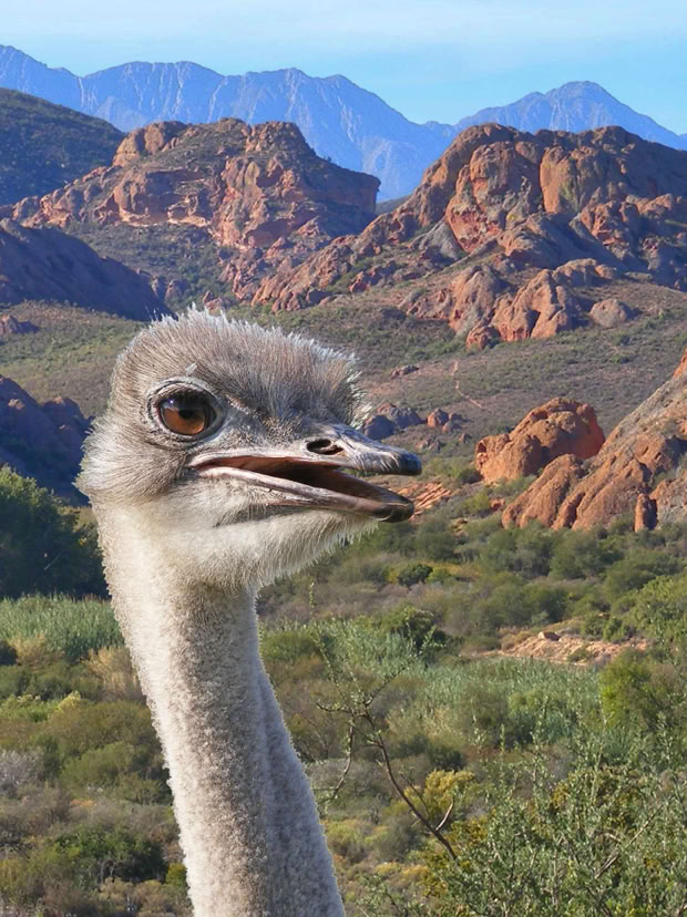
post-apartheid era (1995) when many foreign tourists flocked to South Africa and tour operators saw the wisdom of including R62 as part of their Garden Route tour, thus including Cango Caves and the ostrich farms as a starting point.
It was only in 1978 that the R62 was tarred and the new Huisrivier Pass, built in 1966, truly connected the Calitzdorp side of the Klein Karoo to the western part of this region.R62, as a tourist destination, took off in the post-apartheid era (1995) when many foreign tourists flocked to South Africa and tour operators saw the wisdom of including R62 as part of their Garden Route tour, thus including Cango Caves and the ostrich farms as a starting point.
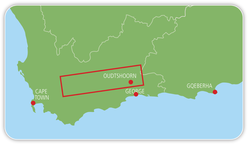
Today, the R62 is marketed as the longest wine route in the world, stretching from before Montagu all the way to Gqeberha (Port Elizabeth) and is atourist destination in itself, just like the famous Route 66 in America which was the inspiration for the R62.This guide, as you will note, does not cover the whole ofthe R62 tourist route as it is just too long for one guide to do it justice, so it sticks mainly to the original road that is designated as the R62 starting just before Cogmanskloof and ending at Oudtshoorn and its surrounding areas.
Getting to Route 62
Most visitors to the R62 will be departing from Cape Town, which is a spectacular journey in itself. The most direct route, at a distance of 173 km, would be via the N1 to Paarl, through the tolled 3.9 km Huguenot Tunnel which
Route 62 Distances
61,7km
76,4km
18km
29,7km
50,4km
34km
Montague
Barrydale
Ladismith
Zoar
Calitzdorp
Outshoorn
De Rust




At Worcester, take the R43 into town until you reach Hoog Straat. Turn left and drive for about 1.5 km till you reach the R60 on your right. This road will take you out of Worcester to Robertson, known as the town of wine and roses, 47 km away. Pass through Robertson, keeping on the R60 until you reach Ashton,the fruit canning factory of South Africa, 19 km away. After leaving Ashton, you depart from the R60 and drive straight through the Langeberg Mountain via Cogmanskloof, the gateway to the R62 and the Klein Karoo.
The land between mountains
Before undertaking your journey on the R62, it is of interest to know what formed this land, as this is the canvas that the history of the Klein Karoo is painted on. Today, we see a broad valley of about 50 km wide and 290 km long, flanked by two massive mountain ranges. The story of how this valley and the mountain ranges formed goes back to the creation of the super continent,Pangaea, 280-235 million years ago, when South America, Africa and the Falklands Plateau collided due to continental drift.
When the Falklands Plateau smashed into Africa from the south, it buckled, crumpled and bent horizontal layers of rock which had started forming in the ancient Agulhas Sea. As well as contorting the once horizontal rock strata, it also formed the massive parallel fold mountain ranges we see today. While these sandstone mountains were slowly forming, the Klein Karoo valley was under shallow water fed by numerous rivers that brought sediments that compacted into layers over time.
opened in 1988. The more scenic free route would be to go over the mountain via the 1948 Du Toitskloof pass. Both routes display the breathtaking sceneryof the inner Du Toitskloof valley and the broad Breede River valley.
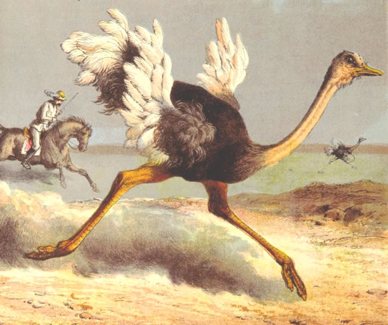
Tobacco was introduced in 1845, making it one of the first commercial growing areas in South Africa and thelargest for its time. The single biggest event to shape the Klein Karoo and made it one of the wealthiest regions of South Africa was the voracious ostrich feather fashion trend from 1865 to1870. It reappeared in 1900 to 1914. What made this region the world capital of the ostrich feather industry was the ability to get ostriches to breed in captivity and the introduction of thenewly invented incubator which increased chick survival rates.
These deposits solidified 145-66 million years ago into a conglomerate rock. The second rock formation is the Kirkwood formation which is found around Oudtshoorn.
As more settlers established themselves, additional passes and poorts were built to give local farmers closer routes to get their produce to market through the Langeberg. At the same time, coastaltowns like George could not get through the Outeniqua forests and gorges so these passes and ports enabled them to make their way round. In the north, poorts and passes started to appear in the Swartberg as Europeans began to settle in the Groot Karoo and needed shorter routes to the coast.
Because the water flow was slow, fine-grained particles managed to settle on the bottom, forming the mudstones and shales we see today. Most ofthe western Klein Karoo valley is made up of what we now call Bokkeveld shale. There are three other notable rock formations of interest, that can also be seen in the valley, each depicting another geological event.Rooikrans (Redstone Hills)was formed after the great lava outpourings in the Karoo 180 million years ago, which brought large-grained sands, stones andpebbles, due to high energy water flow, into the valley.
This fine-grained sandstone/mudstone was deposited under fluvial conditions in the time of dinosaurs, but what it is most known for are the beautifulmasonry stonework of the buildings and feather palaces in Oudtshoorn. The last notable formation of the Klein Karoo is the Cango Group.
A very brief history
In 1689, the Khoi chief, Hykon of the Inkgua tribe, who resided in the Klein Karoo, requested a trade visit by the European settlers at the Cape who had been there for 37 years. This request was granted by Simon van der Stel who sent Ensign Schrijver and 21 men. The route taken followed the old ‘Kaapse Wagenweg’ up the east coast to near Mossel Bay where they used an oldKhoi migration path called the Attaqua Kloof.
By 1729, the Europeans were no longer just visiting but were setting up farms, first for cattle grazing but, with the arid terrain, they moved over to vegetable and fruit farming on the banks of the rivers flowing through this dry land. The establishment of settlements followed with central hubs where the farmers could meet for religiousgatherings (nagmal) and commerce. Churches were built to cement their local authority. Most of these towns were established using the old Attaqua Kloof Pass and Platte Kloof Pass.
A 300 km-long fault line along the southern edge of the Swartberg Mountains formed during the break up of Pangaea. This exposed and uplifted much older rock under the Cape Supergroup. Forming part of this formation are the exposedrock cliffs seen in Schoemanspoort on the way to Cango Caves and also the limestone marine deposits of the Cango Cave system itself.
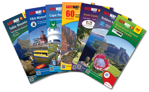
For more in depth information on each region explore our other guides

Notes
This guide is intended, in part, to introduce visitors to the museums of the Cape Peninsula and Cape Town. All information is given in good faith but, as times and facilities may change, the author and publisher cannot be held responsible for any inaccuracies.
Proofreading: Shelley Woode-Smith • Citations available on request • © Richard Smith. • Gateway Guides


DISTRIBUTION PARTNER
www.gatewayguides.co.za
All Rights Reserved
Contact us if you wish to engage with any of our products

IN ASSOCIATION WITH

www.gatewayguides.co.za
All Rights Reserved
Contact us if you wish to engage with any of our products
30 Meyer St. Kenilworth, Cape Town, South Africa